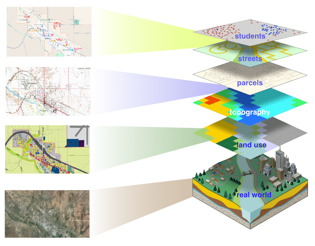
We provide GIS services to many of our clients, especially to school districts.
ARC’s GIS services include geographic analysis of student distribution according to various census and demographic data, development and maintenance of attendance area boundaries, related census, and demographic analysis, optimum bus route determination, and general mapping. We use QGIS, MapInfo, and web-based GIS for our spatial analysis and mapping support services.
Geographic information systems (GIS) are computer systems for capturing, storing, checking, and displaying data related to positions on the Earth’s surface. GIS can show many kinds of data on one map, such as students, streets, political boundaries, buildings, and vegetation. This enables people to see, analyze, and understand patterns and relationships more easily.

